
BIM MODELS
scan data, providing a true-to-field 3D model of current
conditions for engineering, coordination, and construction.
BIM MODELS
scan data, providing a true-to-field 3D model of current
conditions for engineering, coordination, and construction.

BIM MODELS
scan data, providing a true-to-field 3D model of current
conditions for engineering, coordination, and construction.


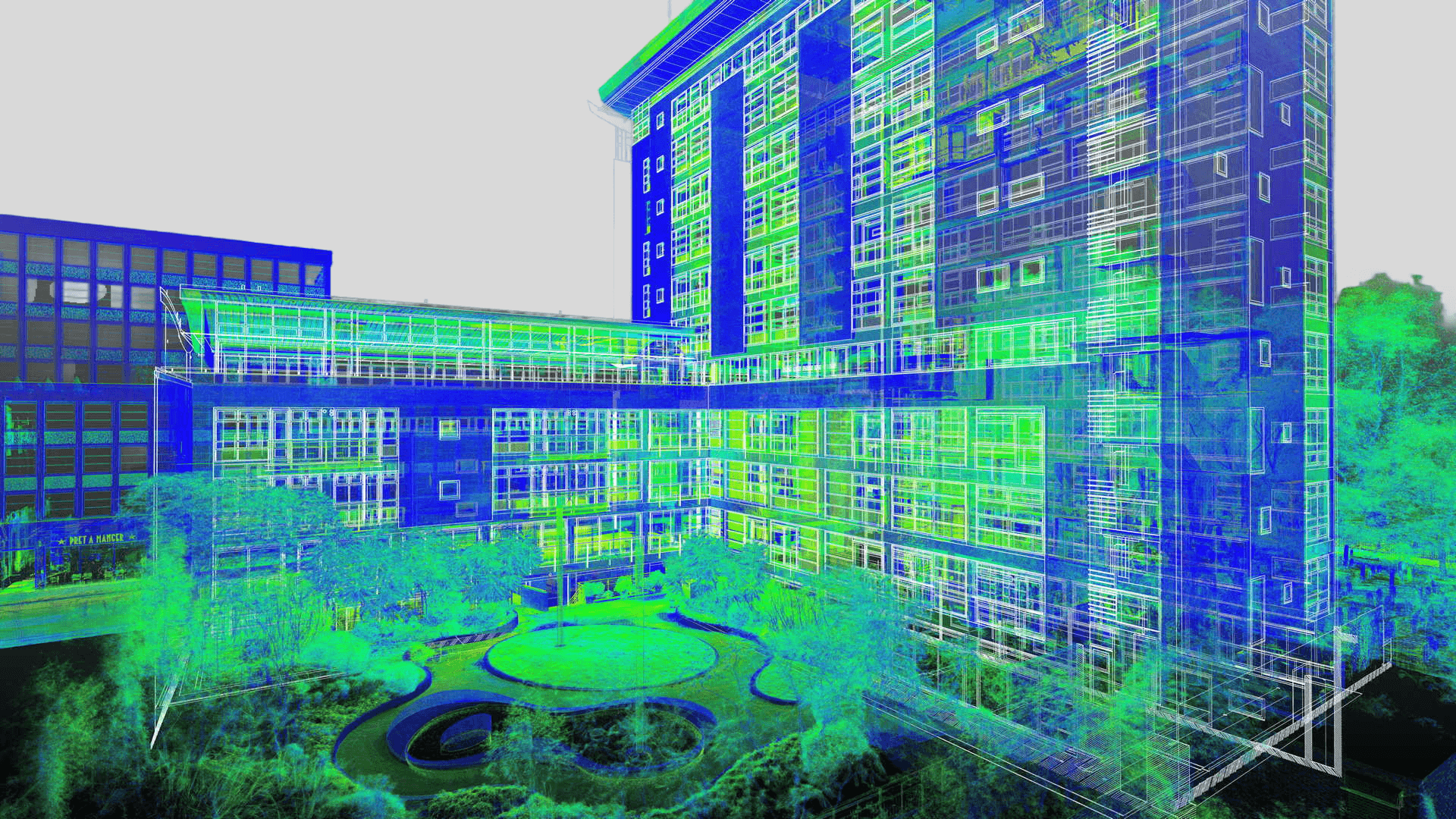
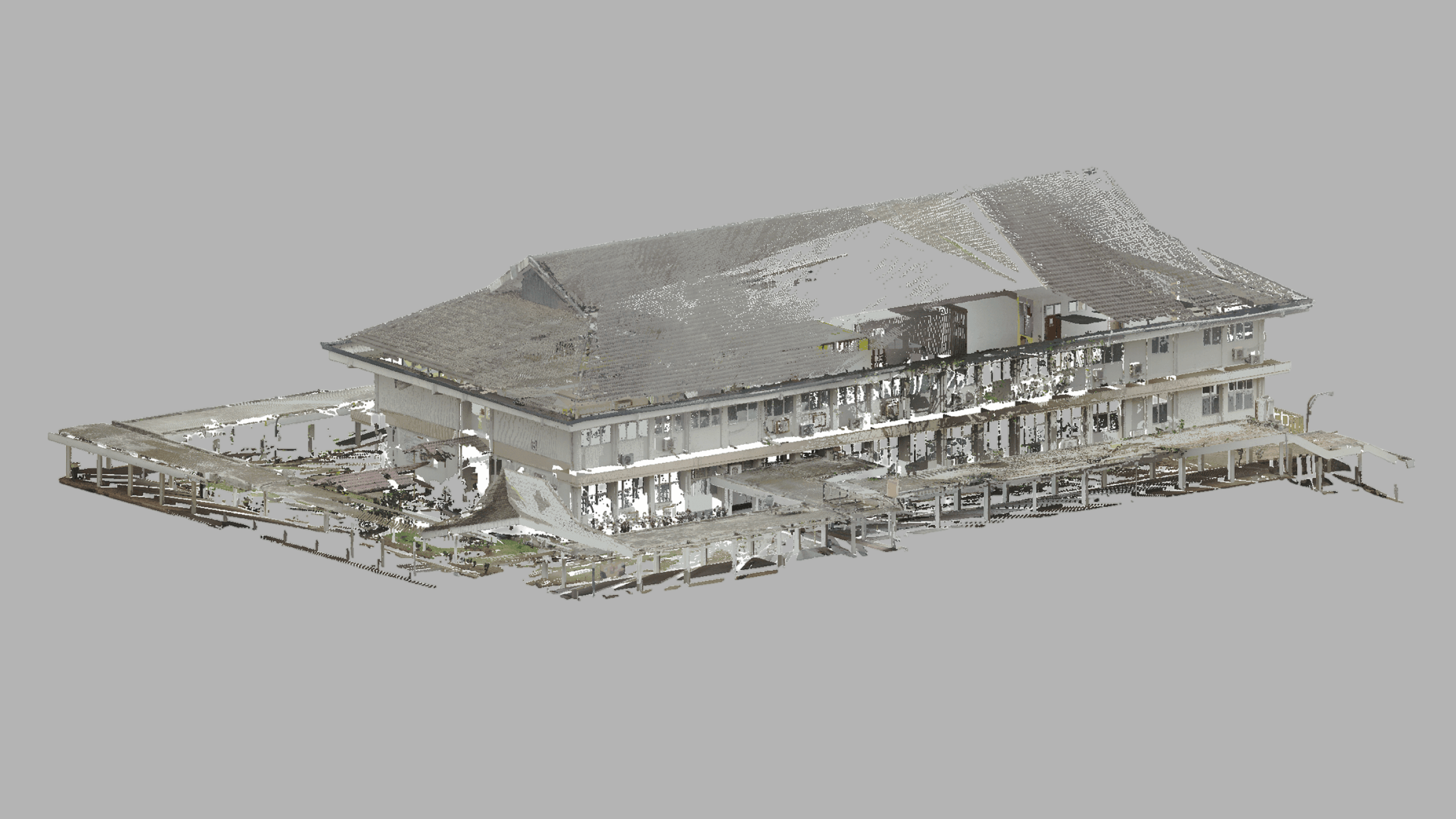
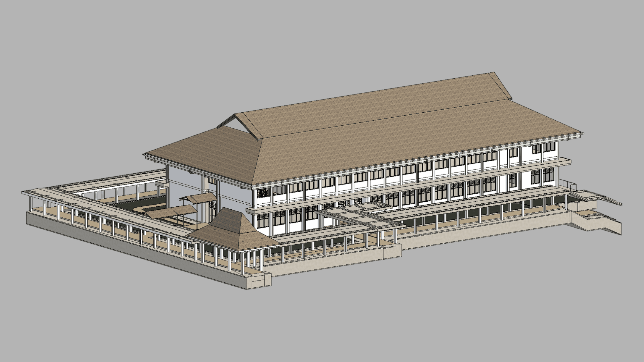
As-Built BIM Models
True-to-Field As-Built BIM Models from 3D Laser Scanning
Buildings and structures often deviate from their original designs due to changes made during construction, renovations, maintenance, and later modifications throughout their service life. As a result, original drawings and design models may no longer reflect the building’s true existing condition, which can lead to errors, clashes, delays, and increased costs during renovation, retrofit, maintenance, and facility management work. To address this, we use terrestrial 3D laser scanning to capture highly accurate as-built spatial data as the foundation for as-built BIM models that represent the structure as it actually exists, including changes and deviations from the original design.
The workflow begins with terrestrial 3D laser scanning, which enables the fast, accurate, and comprehensive capture of existing conditions. Compared with conventional measurement and survey methods, terrestrial 3D laser scanning provides a much higher level of accuracy and detail while reducing the risk of missing critical features or relying on incomplete manual measurements. The resulting point cloud data forms an accurate digital record of the structure, including its architectural, structural, and spatial characteristics. Using this point cloud data, we either update existing BIM models or create new as-built BIM models from the ground up, depending on the project requirements.
As-built BIM models are especially valuable in civil engineering and architectural projects because they provide more than just 3D geometry. They can incorporate architectural elements, structural components, and mechanical, electrical, and plumbing (MEP) systems into a coordinated and information-rich digital model. This allows project teams to work from accurate existing-condition data rather than outdated plans, improving coordination across disciplines and supporting more reliable design, renovation, and construction workflows.
Another major advantage of as-built BIM models is their usefulness across a wide range of downstream applications. From an as-built BIM model, it is possible to generate 2D CAD documentation such as floor plans, ceiling plans, section views, and elevation views, while also supporting visualization, coordination, clash detection, quantity takeoff, and long-term asset management. This makes as-built BIM models particularly useful for renovation projects, building upgrades, space planning, MEP coordination, and documentation of existing facilities.
Because BIM formats are often not fully compatible across different software platforms, exchanging BIM data between programs can introduce complications and potential data loss. To avoid this, we create BIM files directly in the client’s preferred software whenever possible, helping preserve data integrity, functionality, and workflow compatibility. We also tailor the Level of Development (LOD) of each as-built BIM model to match the specific requirements of the project, balancing cost, timeline, and required detail so that the final deliverable is fit for purpose without unnecessary overhead.
Our Equipment
Equipment We Use for As-Built BIM Models
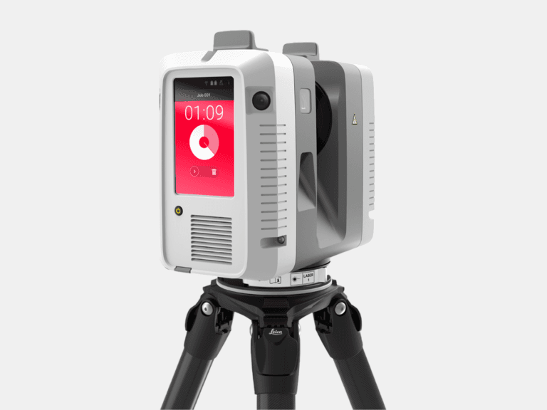
TERRESTRIAL 3D LASER SCANNER
With a range of 0.5-130 m and a 3D accuracy of 1.9 mm @ 10 m, the Leica RTC360 captures high-accuracy terrestrial 3D laser scans of medium to large assets.
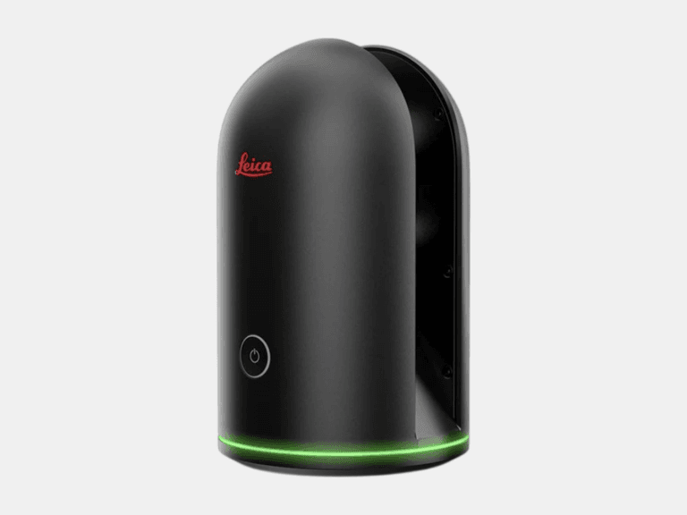
TERRESTRIAL 3D LASER SCANNER
With a range of 0.6-60 m and a 3D accuracy of 4 mm @ 10 m, the Leica BLK360 is ideal for 3D laser scanning in tight, space-constrained areas on small to medium assets.
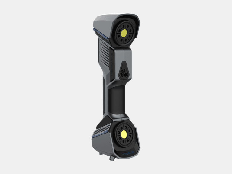
HANDHELD 3D LASER SCANNER
With a 3D accuracy up to 0.02 mm, the FreeScan UE Pro is a metrology-grade handheld 3D laser scanner for high-detail 3D laser scanning of small to medium objects.
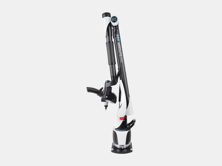
MEASURING ARM CMM
With a 3D accuracy up to 0.013 mm for the AS1 3D laser scanner, the Absolute Arm 7-Axis combines probing and 3D laser scanning for precision measurement of small to medium objects.
LASER TRACKER CMM
With a range of 0.8-160 m and a probing accuracy up to 0.015 mm, the AT500 is used to probe small to large objects for precision inspection, alignment, and verification.
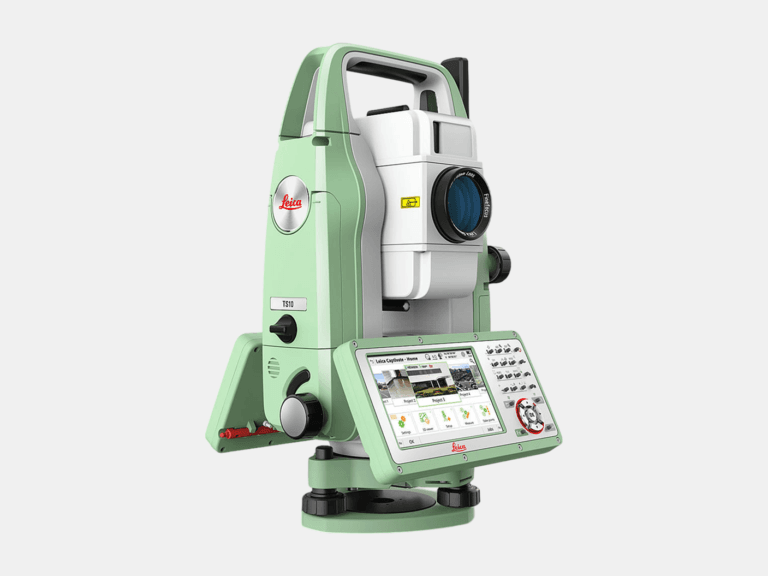
TOTAL STATION
With an angular accuracy of 1″, a distance accuracy up to 1 mm, and a range of 0.9-3,500 m, the TS10 establishes survey control that enables the most accurate terrestrial 3D laser scan registration possible.
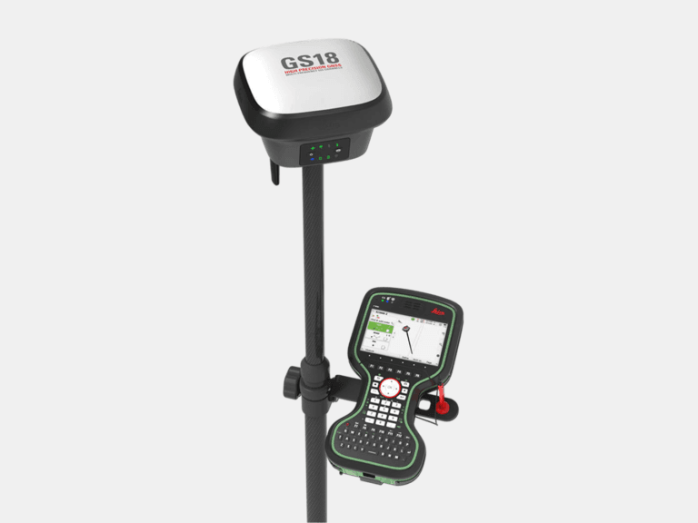
RTK GNSS ROVER
With an accuracy up to 8 mm and tilt compensation, the GS18 T quickly georeferences data into your required coordinate system for consistent field-to-office alignment.
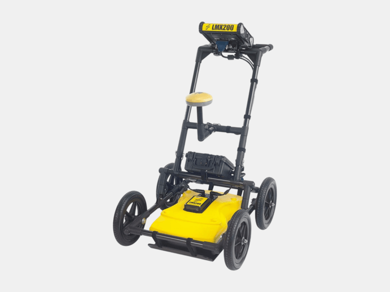
GROUND PENETRATING RADAR (GPR)
With an ultra-wideband 250 MHz GPR antenna and a depth penetration up to 8 m, the LMX200 maps buried utilities, including metallic and non-metallic pipes, for confident subsurface awareness.
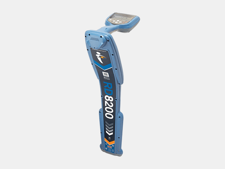
CABLE & PIPE LOCATOR
With a depth measurement accuracy of ±3%, a locate accuracy of ±5%, and a depth readout up to 30 m, the RD8200 pinpoints underground cables and pipes with high confidence.
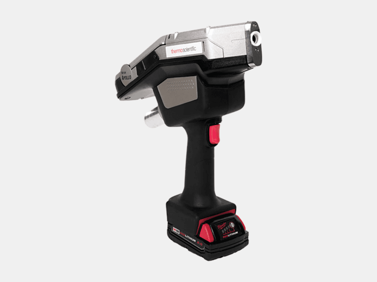
HANDHELD LIBS ANALYZER
Using a handheld LIBS analyzer, the Niton Apollo detects C, Al, Si, Ti, V, Cr, Mn, Co, Ni, Cu, Nb, Mo, and W on-site to differentiate steel grades beyond XRF.
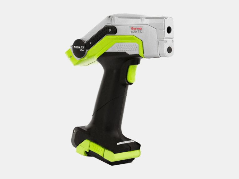
HANDHELD XRF ANALYZER
Using a handheld XRF analyzer, the Niton XL5 Plus identifies and quantifies elements from Mg to U on-site for rapid alloy identification and PMI.
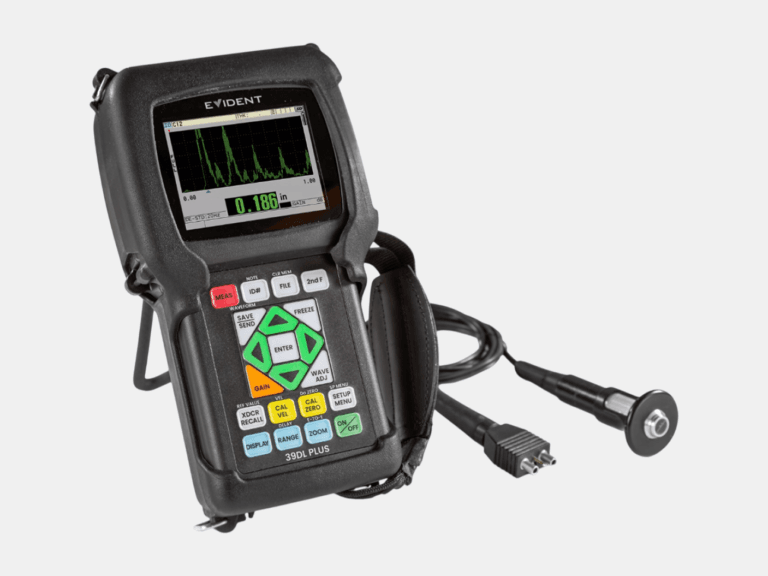
ULTRASONIC THICKNESS GAUGE
With a thickness range of 0.08-635 mm and multilayer capability to measure up to four individual layers, the 39DL PLUS delivers reliable ultrasonic thickness measurements.
Common Applications
Where As-Built BIM Models Deliver Value
As-Built Modeling
Scan To BIM - From Accurate Point Cloud to Precise BIM Models
As-Built Deliverables