
DESIGN MODELS
drawings are produced from 3D laser scan data to support
retrofit work, layout validation, and engineering deliverables.

DESIGN MODELS
drawings are produced from 3D laser scan data to support
retrofit work, layout validation, and engineering deliverables.

DESIGN MODELS
drawings are produced from 3D laser scan data to support
retrofit work, layout validation, and engineering deliverables.


As-Built Plant Design Models
Scan-to-Plant Design Models & Piping Isometrics
In industrial facilities, existing conditions often differ from original drawings due to modifications made during construction, maintenance, repairs, expansions, and operational changes over time. As a result, legacy drawings and design models may no longer accurately represent how a plant exists in the field, increasing the risk of errors during inspection, maintenance, refurbishment, revamping, and retrofit work. To address this, we use high-accuracy terrestrial 3D laser scanning to capture as-built spatial data as the basis for accurate as-built 3D plant design models in AutoCAD Plant 3D.
Terrestrial 3D laser scanning allows existing plant conditions to be documented quickly, accurately, and in full detail. Compared with conventional measurement and survey methods, it provides greater data density, broader coverage, and a much lower risk of missing critical features. The resulting point cloud data forms an accurate digital record of the plant, including piping, equipment, structures, access platforms, cable trays, and surrounding spatial relationships. This is especially valuable in congested industrial environments where manual measurement is slower, more disruptive, and less reliable.
For critical equipment and accuracy-sensitive areas such as tie-in points, we can supplement terrestrial 3D laser scan data with metrology-grade handheld 3D laser scan data to achieve a higher level of accuracy and detail. While terrestrial 3D laser scanners typically provide 3D accuracy of up to 2 mm, metrology-grade handheld 3D laser scanners can achieve 3D accuracy of up to 0.02 mm. By combining these datasets, we maintain the broad coverage of terrestrial 3D laser scanning while refining critical areas with higher-accuracy, higher-detail 3D laser scan data.
Using this point cloud data, we create as-built 3D plant design models in AutoCAD Plant 3D. These models serve a similar purpose to BIM but are specifically suited to industrial environments such as petrochemical plants, manufacturing facilities, power and energy facilities, and mining processing plants. To improve modeling efficiency and accuracy, we also incorporate Faro As-Built software into our workflow. From the as-built 3D plant design model, we can generate as-built piping isometric drawings and other 2D CAD documentation while maintaining consistency across all deliverables.
An important part of our workflow is the capture and integration of plant tagging information. Where existing documentation is available, we use it to identify and verify line numbers, equipment tags, and other relevant asset information. When this information is unavailable or needs to be confirmed, we record it on site by photographing tagging information directly in the field and linking it to the relevant locations within the point cloud data. This allows tagging information to be referenced accurately during modeling and later incorporated into AutoCAD Plant 3D.
Because as-built 3D plant design models are created directly from accurate 3D laser scan data, they provide a dependable basis for inspection, maintenance, refurbishment, revamping, retrofit projects, brownfield modifications, and general plant documentation. We work closely with each client to define the appropriate modeling scope, level of development, and deliverable format so that the final model is accurate, practical, and tailored to the project’s technical and operational requirements.
Our Equipment
Equipment We Use for As-Built Plant Design Models
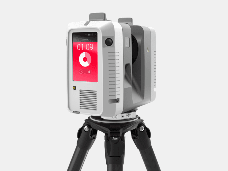
TERRESTRIAL 3D LASER SCANNER
With a range of 0.5-130 m and a 3D accuracy of 1.9 mm @ 10 m, the Leica RTC360 captures high-accuracy terrestrial 3D laser scans of medium to large assets.
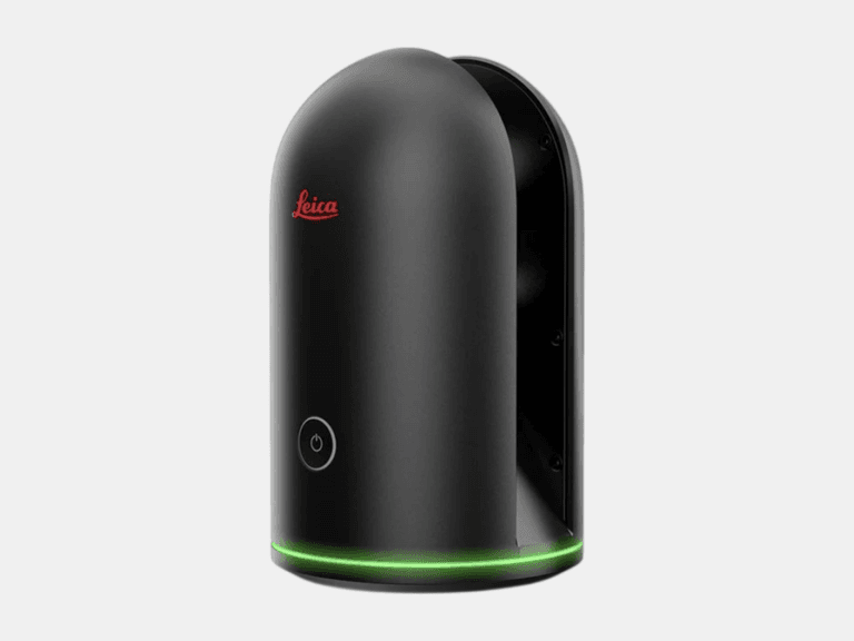
TERRESTRIAL 3D LASER SCANNER
With a range of 0.6-60 m and a 3D accuracy of 4 mm @ 10 m, the Leica BLK360 is ideal for 3D laser scanning in tight, space-constrained areas on small to medium assets.
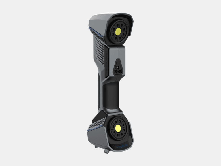
HANDHELD 3D LASER SCANNER
With a 3D accuracy up to 0.02 mm, the FreeScan UE Pro is a metrology-grade handheld 3D laser scanner for high-detail 3D laser scanning of small to medium objects.
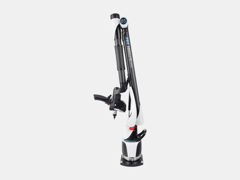
MEASURING ARM CMM
With a 3D accuracy up to 0.013 mm for the AS1 3D laser scanner, the Absolute Arm 7-Axis combines probing and 3D laser scanning for precision measurement of small to medium objects.
LASER TRACKER CMM
With a range of 0.8-160 m and a probing accuracy up to 0.015 mm, the AT500 is used to probe small to large objects for precision inspection, alignment, and verification.
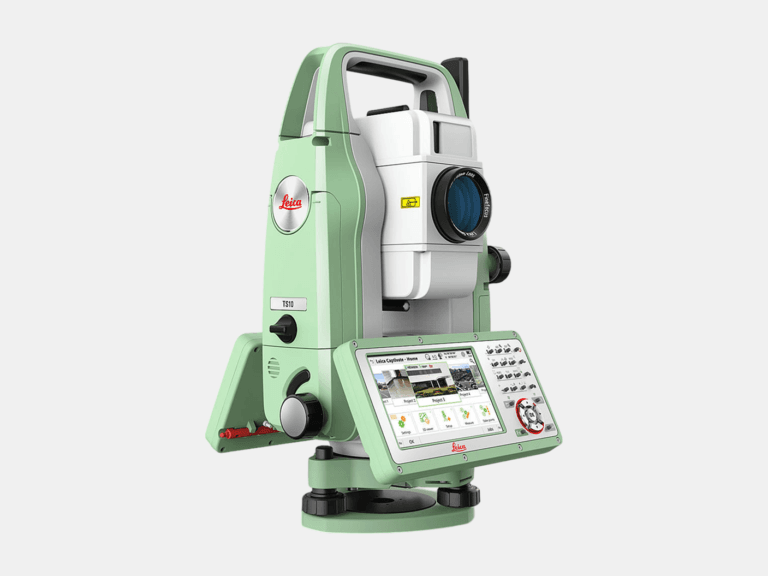
TOTAL STATION
With an angular accuracy of 1″, a distance accuracy up to 1 mm, and a range of 0.9-3,500 m, the TS10 establishes survey control that enables the most accurate terrestrial 3D laser scan registration possible.
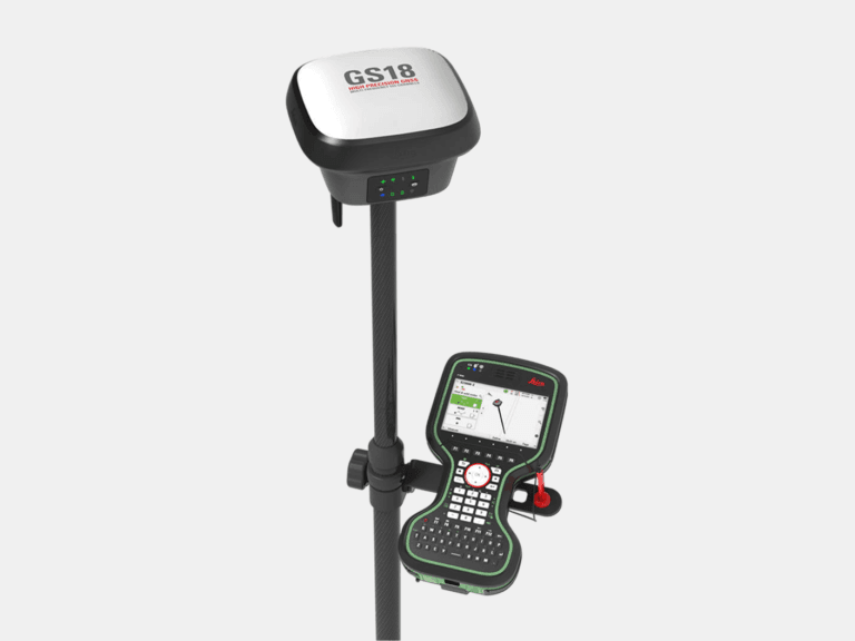
RTK GNSS ROVER
With an accuracy up to 8 mm and tilt compensation, the GS18 T quickly georeferences data into your required coordinate system for consistent field-to-office alignment.
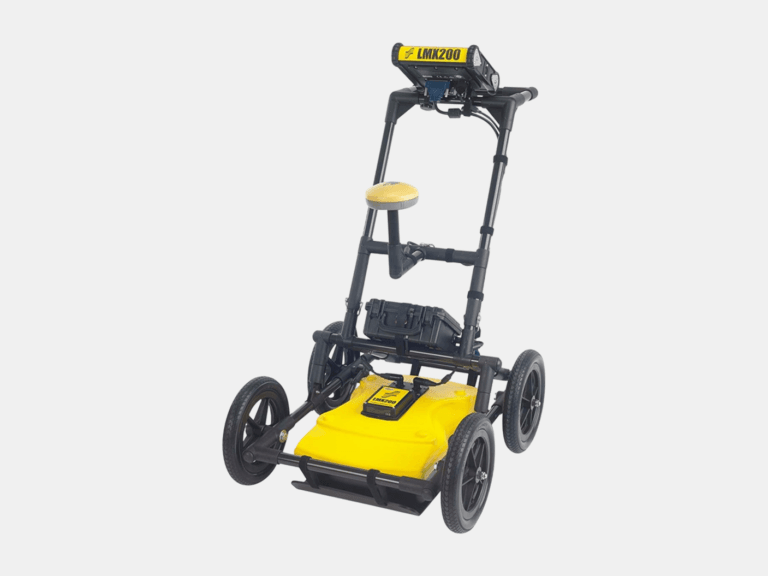
GROUND PENETRATING RADAR (GPR)
With an ultra-wideband 250 MHz GPR antenna and a depth penetration up to 8 m, the LMX200 maps buried utilities, including metallic and non-metallic pipes, for confident subsurface awareness.
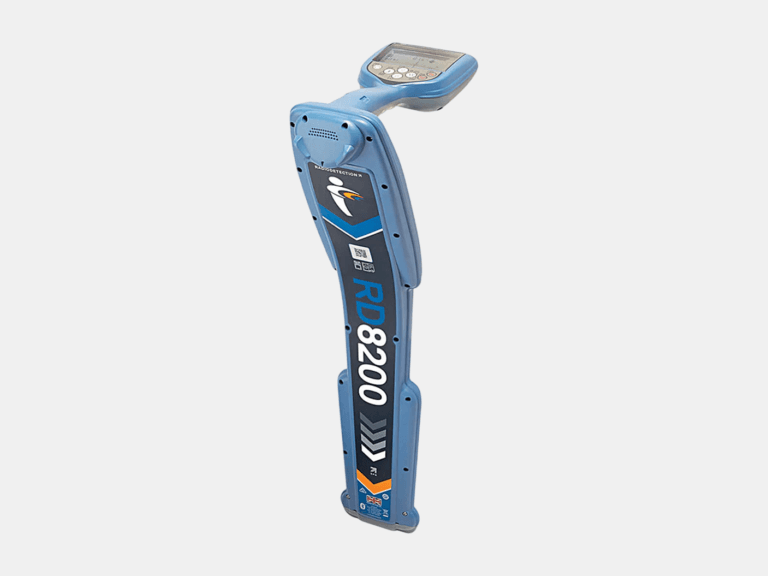
CABLE & PIPE LOCATOR
With a depth measurement accuracy of ±3%, a locate accuracy of ±5%, and a depth readout up to 30 m, the RD8200 pinpoints underground cables and pipes with high confidence.
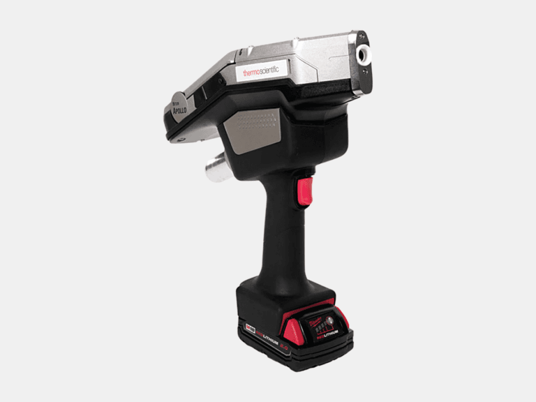
HANDHELD LIBS ANALYZER
Using a handheld LIBS analyzer, the Niton Apollo detects C, Al, Si, Ti, V, Cr, Mn, Co, Ni, Cu, Nb, Mo, and W on-site to differentiate steel grades beyond XRF.
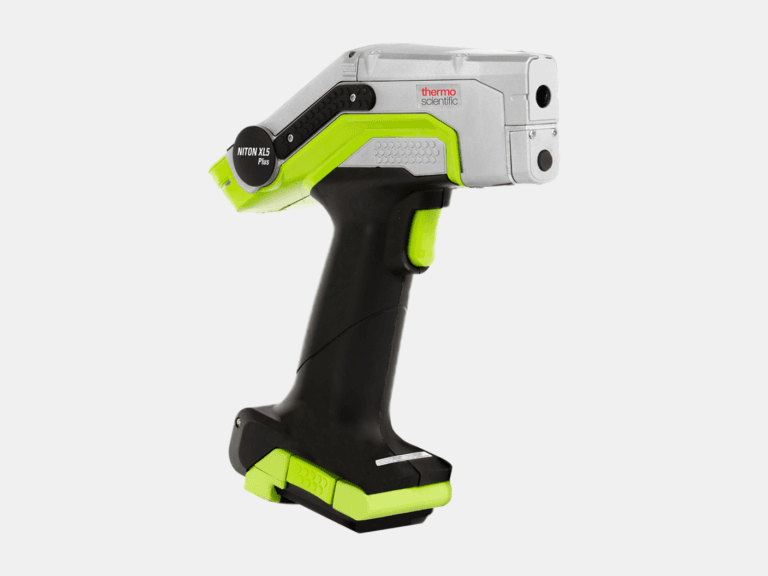
HANDHELD XRF ANALYZER
Using a handheld XRF analyzer, the Niton XL5 Plus identifies and quantifies elements from Mg to U on-site for rapid alloy identification and PMI.
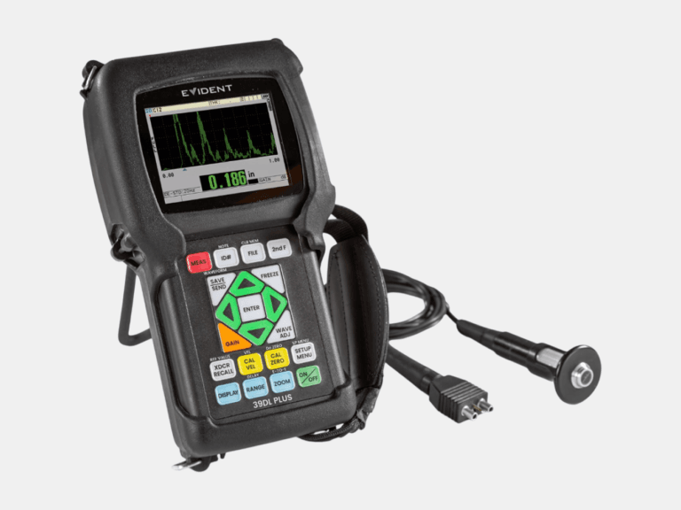
ULTRASONIC THICKNESS GAUGE
With a thickness range of 0.08-635 mm and multilayer capability to measure up to four individual layers, the 39DL PLUS delivers reliable ultrasonic thickness measurements.
Common Applications
Where As-Built Plant Design Models Deliver Value
As-Built Deliverables