MESH MODELS
detailed 3D mesh models in a range of 3D mesh formats—ideal
for visualization, reverse engineering, and digital archiving.

MESH MODELS
detailed 3D mesh models in a range of 3D mesh formats—ideal
for visualization, reverse engineering, and digital archiving.

MESH MODELS
detailed 3D mesh models in a range of 3D mesh formats—ideal
for visualization, reverse engineering, and digital archiving.


As-Built 3D Mesh Models
As-Built 3D Mesh Models from 3D Laser Scan Data
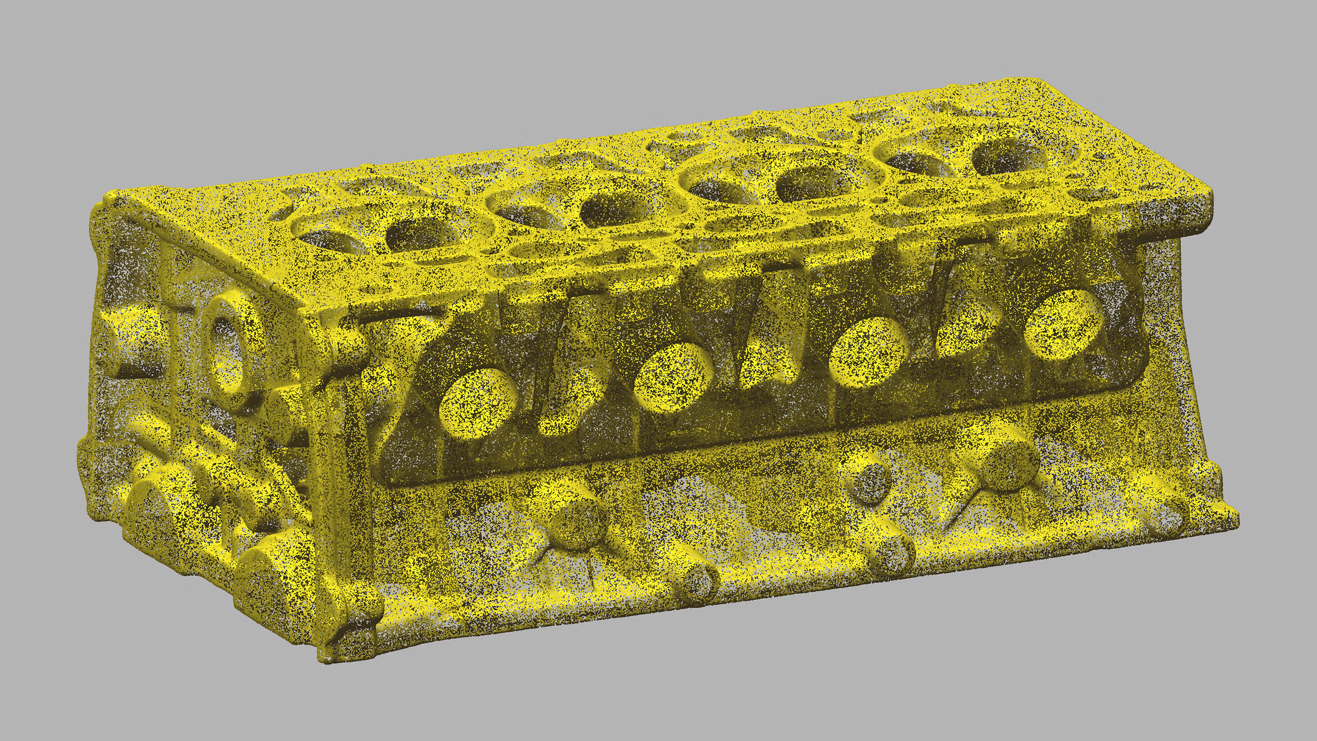
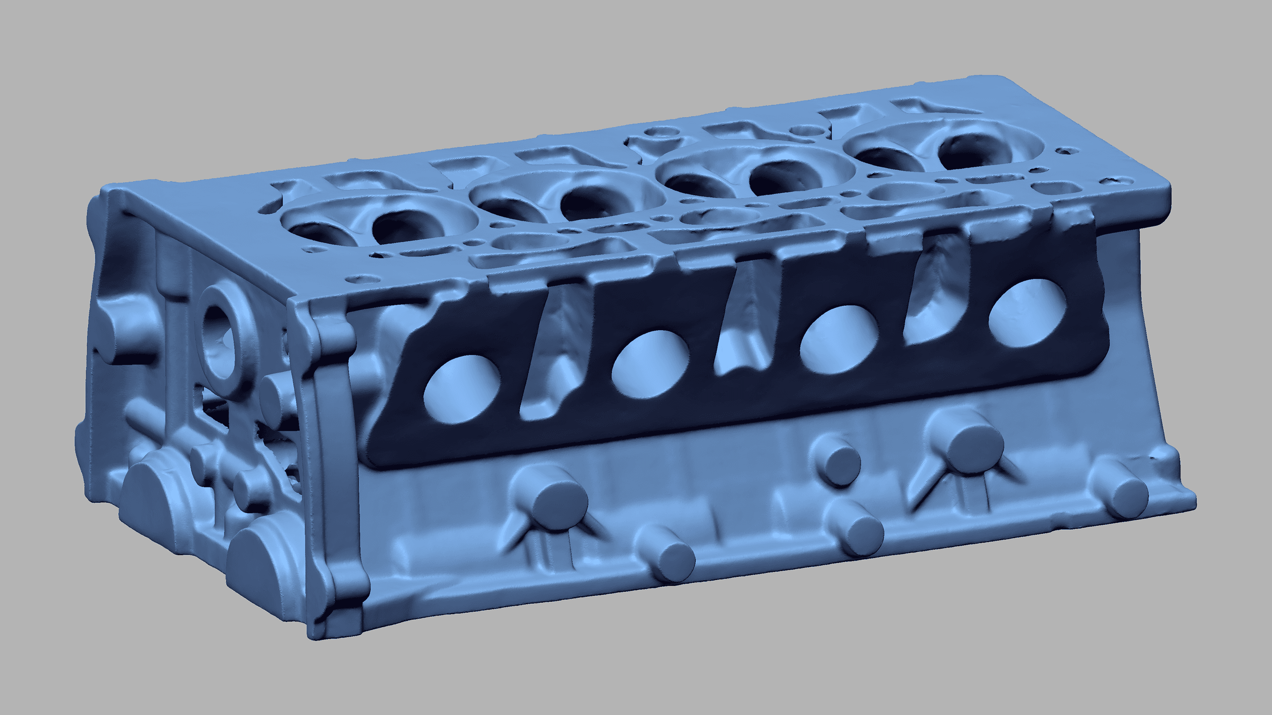
Point cloud data obtained through 3D laser scanning can be converted into as-built 3D mesh models for clients who require a digital surface model of an object, structure, or environment. An as-built 3D mesh model is a digital representation of a surface, composed of vertices, edges, and faces that define its shape and structure in 3D space. It is created from point cloud data through a process known as triangulation, in which individual data points are connected to form a continuous mesh surface made up of triangles. This allows highly detailed 3D laser scan data to be transformed into a surface-based model that is easier to visualize, interpret, and use across a wide range of downstream applications.
One of the main advantages of as-built 3D mesh models is that their level of detail can be adjusted according to each client’s requirements. Smaller and denser triangles provide higher resolution and greater surface detail, while larger and less dense triangles produce lower resolution models with smaller file sizes. This flexibility allows as-built 3D mesh models to be optimized for different purposes, whether the priority is maximum geometric detail, easier file handling, or smoother integration into specific software and workflows. Depending on the project, as-built 3D mesh models can be generated for individual parts, machinery, complex surfaces, buildings, or large-scale facilities.
As-built 3D mesh models are often used as intermediate models for the creation of other deliverables, especially as-built 3D CAD models and 2D CAD documentation. They can also be used directly for inspection, storage tank inspection & calibration, volume surveys, deformation & wear analysis, topographic mapping & georeferencing, and propeller inspection. Because as-built 3D mesh models provide a surface-based representation of existing conditions, they are especially useful when surface geometry, contour, and visual interpretation are important.
When required, we can also apply the real color of the object or environment captured through 3D laser scanning to as-built 3D mesh models using images captured by the 3D laser scanner. This makes as-built 3D mesh models especially useful for VR/AR & 3D digital content, including simulations, animations, video games, and advertisements. They also provide a flexible option for clients who prefer to carry out their own downstream processing while still working from an accurate digital representation of existing conditions.
Our Equipment
Equipment We Use for As-Built 3D Mesh Models
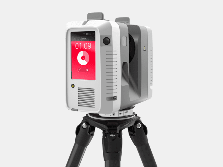
TERRESTRIAL 3D LASER SCANNER
With a range of 0.5-130 m and a 3D accuracy of 1.9 mm @ 10 m, the Leica RTC360 captures high-accuracy terrestrial 3D laser scans of medium to large assets.
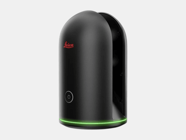
TERRESTRIAL 3D LASER SCANNER
With a range of 0.6-60 m and a 3D accuracy of 4 mm @ 10 m, the Leica BLK360 is ideal for 3D laser scanning in tight, space-constrained areas on small to medium assets.
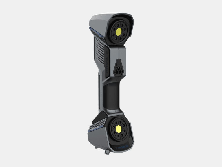
HANDHELD 3D LASER SCANNER
With a 3D accuracy up to 0.02 mm, the FreeScan UE Pro is a metrology-grade handheld 3D laser scanner for high-detail 3D laser scanning of small to medium objects.
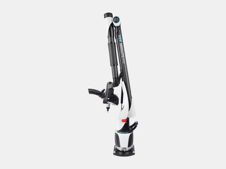
MEASURING ARM CMM
With a 3D accuracy up to 0.013 mm for the AS1 3D laser scanner, the Absolute Arm 7-Axis combines probing and 3D laser scanning for precision measurement of small to medium objects.
LASER TRACKER CMM
With a range of 0.8-160 m and a probing accuracy up to 0.015 mm, the AT500 is used to probe small to large objects for precision inspection, alignment, and verification.
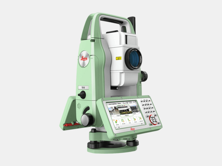
TOTAL STATION
With an angular accuracy of 1″, a distance accuracy up to 1 mm, and a range of 0.9-3,500 m, the TS10 establishes survey control that enables the most accurate terrestrial 3D laser scan registration possible.
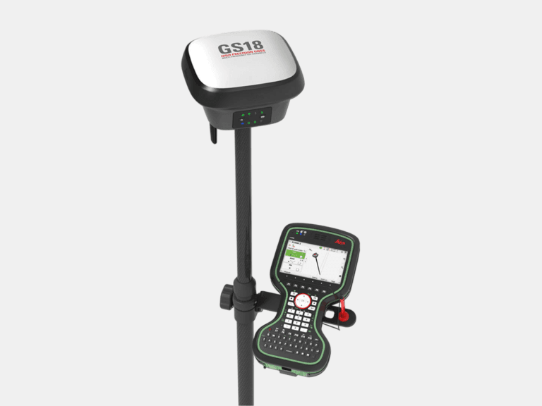
RTK GNSS ROVER
With an accuracy up to 8 mm and tilt compensation, the GS18 T quickly georeferences data into your required coordinate system for consistent field-to-office alignment.
Common Applications
Where As-Built 3D Mesh Models Deliver Value
As-Built Modeling
Scan To Mesh - From Accurate Point Cloud to Precise 3D Mesh Models