
MAPPING &
GEOREFERENCING
topographic models. Additionally, with GNSS RTK rovers, we
georeference your project data to real-world coordinates.

MAPPING &
GEOREFERENCING
topographic models. Additionally, with GNSS RTK rovers, we
georeference your project data to real-world coordinates.

MAPPING &
GEOREFERENCING
topographic models. Additionally, with GNSS RTK rovers, we
georeference your project data to real-world coordinates.


Topographic Mapping & Georeferencing
Topographic Mapping & GNSS Georeferencing for 2D & 3D Models
Topographic mapping & georeferencing depend on accurate spatial data to ensure that terrain, site features, and existing conditions are documented in a way that supports planning, design, construction, and long-term monitoring. Terrestrial 3D laser scanning provides a highly effective method for capturing this information in dense detail, allowing accurate topographic data to be extracted directly from point cloud data. Depending on project requirements, this information can be delivered as 2D topographic drawings, 3D topographic terrain models, or other as-built digital outputs suited to the client’s workflow and intended application.
A major advantage of terrestrial 3D laser scanning is its ability to capture surface geometry with a much higher level of detail and accuracy than many alternative methods. With accuracy of up to 2 mm, terrestrial 3D laser scanning can significantly outperform methods such as drone-based LiDAR or photogrammetry, which often operate at accuracies around 5 cm. This makes terrestrial 3D laser scanning especially valuable where subtle changes in elevation, slope, grading, or surface condition must be captured reliably. Whether applied to urban development, industrial sites, civil infrastructure, or large outdoor environments, this level of detail provides a dependable basis for design, verification, and ongoing site assessment.
Because the data is captured in high density, terrestrial 3D laser scanning is well suited not only to general topographic mapping but also to complex sites with structures, equipment, vegetation boundaries, access routes, and irregular terrain. The resulting topographic information can also be incorporated into as-built BIM models, plant design models, and other engineering deliverables, adding accurate site context that supports coordination and decision-making across disciplines.
For georeferencing, we use GNSS RTK rovers to collect highly accurate geographic coordinates of control points such as reference spheres and checkered targets. These coordinates allow us to georeference a broad range of as-built data, including registered point clouds, 3D mesh models, 3D CAD models, BIM models, 3D plant design models, 2D CAD documentation, topographic terrain models, and GPR underground mapping data. By transforming these datasets from local coordinates into a true geographic coordinate system—commonly WGS 84 or another system specified by the client—we establish reliable spatial alignment that supports GIS integration, monitoring, change detection, planning, maintenance, and broader geospatial coordination across engineering, construction, industrial, and environmental applications.
Our Equipment
Equipment We Use for Topographic Mapping & Georeferencing
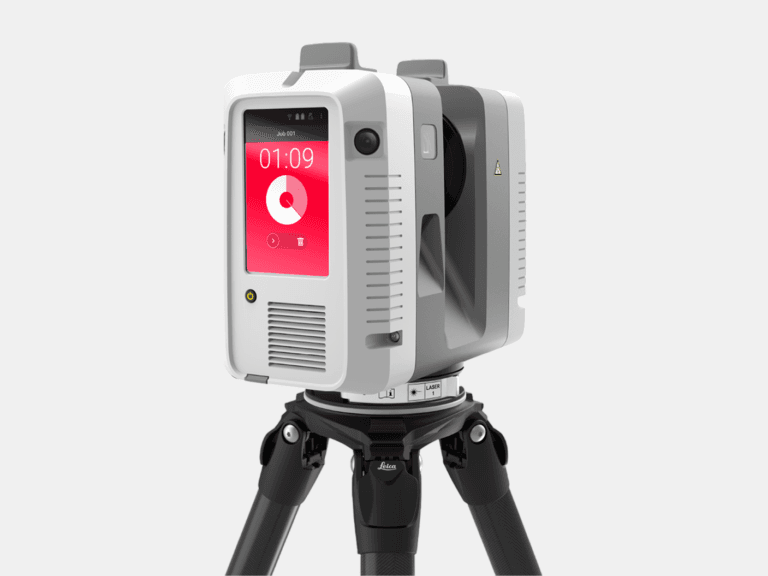
TERRESTRIAL 3D LASER SCANNER
With a range of 0.5-130 m and a 3D accuracy of 1.9 mm @ 10 m, the Leica RTC360 captures high-accuracy terrestrial 3D laser scans of medium to large assets.
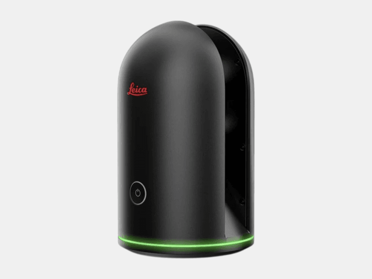
TERRESTRIAL 3D LASER SCANNER
With a range of 0.6-60 m and a 3D accuracy of 4 mm @ 10 m, the Leica BLK360 is ideal for 3D laser scanning in tight, space-constrained areas on small to medium assets.
LASER TRACKER CMM
With a range of 0.8-160 m and a probing accuracy up to 0.015 mm, the AT500 is used to probe small to large objects for precision inspection, alignment, and verification.
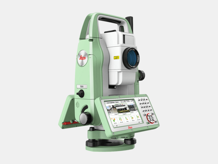
TOTAL STATION
With an angular accuracy of 1″, a distance accuracy up to 1 mm, and a range of 0.9-3,500 m, the TS10 establishes survey control that enables the most accurate terrestrial 3D laser scan registration possible.
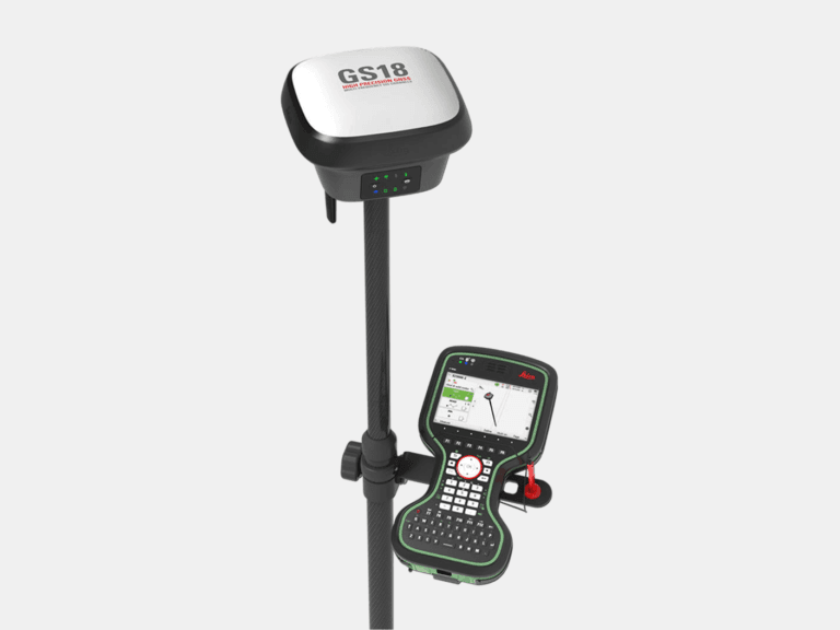
RTK GNSS ROVER
With an accuracy up to 8 mm and tilt compensation, the GS18 T quickly georeferences data into your required coordinate system for consistent field-to-office alignment.
Common Applications
Where Topographic Mapping & Georeferencing Deliver Value
As-Built Deliverables