 Image 1")
(UNDERGROUND
MAPPING)
mapping in both 2D and 3D, helping identify subsurface
features and utilities with clear, usable results.
 Image 2")
(UNDERGROUND
MAPPING)
mapping in both 2D and 3D, helping identify subsurface
features and utilities with clear, usable results.
 Image 3")
(UNDERGROUND
MAPPING)
mapping in both 2D and 3D, helping identify subsurface
features and utilities with clear, usable results.
 Image 1")
 Image 2")
 Image 3")
GPR (Underground Mapping)
GPR Underground Mapping in 2D & 3D for Utilities
Ground penetrating radar (GPR) is a highly effective, non-intrusive, and non-destructive surveying method used to detect and visualize subsurface objects by transmitting radar pulses into the ground. It is widely used to locate underground utilities such as cables, pipelines, and other buried infrastructure before excavation, construction, or maintenance work begins. Because GPR can penetrate a range of ground materials and reveal changes in subsurface conditions, it provides valuable information about the location and depth of underground features that may not be visible from the surface.
GPR underground mapping is especially useful on projects where underground utility information is incomplete, outdated, or unavailable. By identifying buried assets before excavation, GPR helps reduce the risk of accidental strikes, project delays, safety incidents, and costly damage to critical infrastructure. Depending on site conditions and material characteristics, GPR can detect utilities and other buried objects at significant depth, making it a practical solution for a wide variety of civil, industrial, and construction applications.
When combined with GNSS data, GPR data can be converted into accurate as-built 2D survey maps that show the position and depth of underground utilities with reliable spatial reference. These maps are highly valuable for excavation planning, utility coordination, site development, and verification work, especially where accurate underground information is essential for safe and efficient project execution. Georeferenced GPR data can also be integrated with other survey and measurement datasets to improve coordination between aboveground and underground conditions.
In addition to mapping, GPR data can also be used in more advanced design and modeling workflows. By integrating GPR data into CAD software, we can develop as-built 2D and 3D models of subsurface infrastructure that provide a clearer representation of underground utility networks and buried features. These models can then be incorporated into as-built BIM models and plant design models, helping create a more complete view of both aboveground and underground conditions. This integrated approach improves planning, supports safer excavation, and reduces the likelihood of accidental damage to essential underground utilities.
Our Equipment
Equipment We Use for GPR (Underground Mapping)
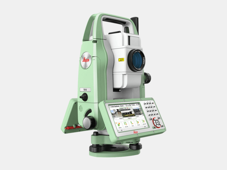
TOTAL STATION
With an angular accuracy of 1″, a distance accuracy up to 1 mm, and a range of 0.9-3,500 m, the TS10 establishes survey control that enables the most accurate terrestrial 3D laser scan registration possible.
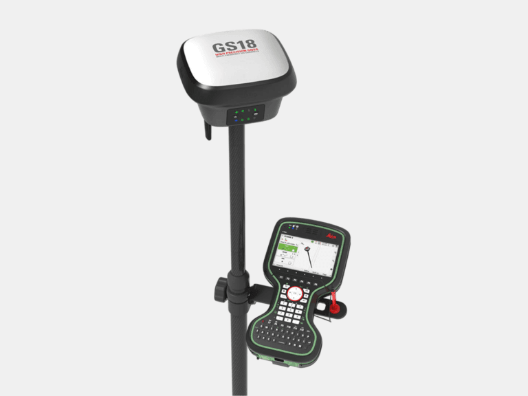
RTK GNSS ROVER
With an accuracy up to 8 mm and tilt compensation, the GS18 T quickly georeferences data into your required coordinate system for consistent field-to-office alignment.
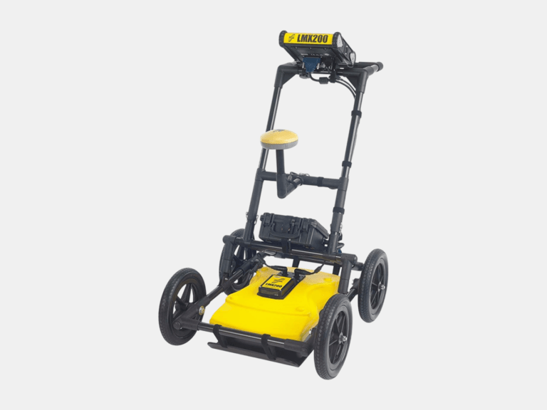
GROUND PENETRATING RADAR (GPR)
With an ultra-wideband 250 MHz GPR antenna and a depth penetration up to 8 m, the LMX200 maps buried utilities, including metallic and non-metallic pipes, for confident subsurface awareness.
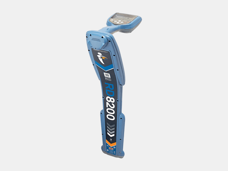
CABLE & PIPE LOCATOR
With a depth measurement accuracy of ±3%, a locate accuracy of ±5%, and a depth readout up to 30 m, the RD8200 pinpoints underground cables and pipes with high confidence.
Common Applications
Where GPR (Underground Mapping) Delivers Value
As-Built Deliverables