VERIFICATION
to each other), we deliver clash detection and deviation
checks that reduce rework and confirm field conditions.

VERIFICATION
to each other), we deliver clash detection and deviation
checks that reduce rework and confirm field conditions.

VERIFICATION
to each other), we deliver clash detection and deviation
checks that reduce rework and confirm field conditions.


Construction Verification
Construction Verification with Clash Detection & Deviation Models
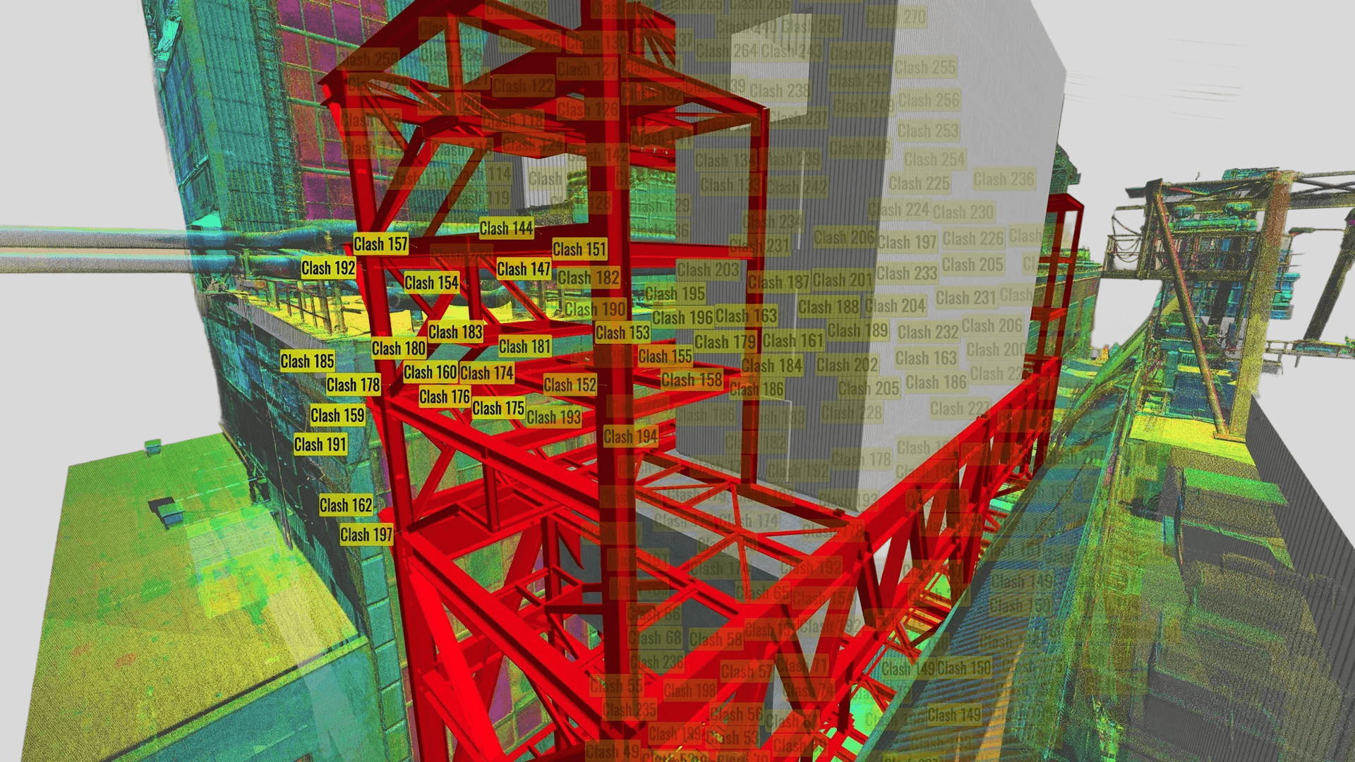
Construction verification is critical for confirming that completed work matches the original design intent and that deviations are identified before they lead to larger project issues. By comparing an existing design model with point cloud data captured through 3D laser scanning—or by directly comparing separate sets of 3D laser scan data collected at different stages—we can detect clashes, dimensional deviations, and installation errors with a high level of precision. This helps reduce rework, material waste, delays, and the cost of correcting issues after construction has progressed.
One of the key advantages of 3D laser scanning in construction verification is the ability to capture highly detailed as-built spatial data across the full site rather than relying on limited spot-check measurements. This makes it possible to evaluate whether installed components, structural geometry, piping, and surrounding features conform to the design model more comprehensively than with conventional manual methods. It is especially valuable on complex projects where coordination issues and dimensional discrepancies can be difficult to identify through traditional measurement alone.
Our construction verification workflow includes the generation of detailed 2D and 3D deviation/deformation color maps that clearly show differences between the design model and the as-built condition or between as-built conditions over time. These analyses can be performed by comparing 3D laser scan data with the original BIM or CAD model, or by comparing sequential 3D laser scan datasets collected at different project milestones. Regular 3D laser scanning allows teams to monitor progress, identify emerging issues early, and maintain a higher standard of quality control throughout construction. The resulting data can also be integrated into BIM workflows so that design and coordination models reflect verified as-built conditions more accurately.
Our construction verification services can also include detailed dimensional and geometric dimensioning and tolerancing (GD&T)-based evaluation where required. This includes cross-sectional deviation analysis, surface flatness and levelness assessments, slope analysis, tunnel inspection, volume surveys, and geometric checks such as straightness, flatness, circularity, cylindricity, angularity, perpendicularity, parallelism, position, concentricity, and symmetry. By combining these analyses with high-accuracy 3D laser scan data, we provide a clearer understanding of whether the final built condition meets design requirements and project tolerances.
Our Equipment
Equipment We Use for Construction Verification
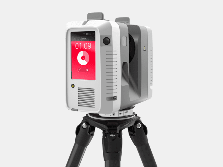
TERRESTRIAL 3D LASER SCANNER
With a range of 0.5-130 m and a 3D accuracy of 1.9 mm @ 10 m, the Leica RTC360 captures high-accuracy terrestrial 3D laser scans of medium to large assets.
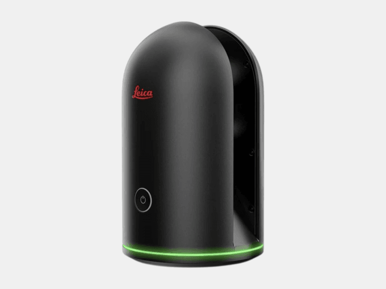
TERRESTRIAL 3D LASER SCANNER
With a range of 0.6-60 m and a 3D accuracy of 4 mm @ 10 m, the Leica BLK360 is ideal for 3D laser scanning in tight, space-constrained areas on small to medium assets.
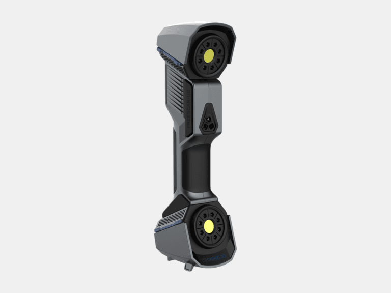
HANDHELD 3D LASER SCANNER
With a 3D accuracy up to 0.02 mm, the FreeScan UE Pro is a metrology-grade handheld 3D laser scanner for high-detail 3D laser scanning of small to medium objects.
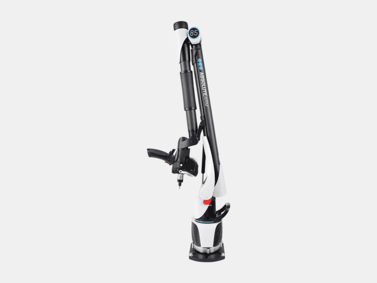
MEASURING ARM CMM
With a 3D accuracy up to 0.013 mm for the AS1 3D laser scanner, the Absolute Arm 7-Axis combines probing and 3D laser scanning for precision measurement of small to medium objects.
LASER TRACKER CMM
With a range of 0.8-160 m and a probing accuracy up to 0.015 mm, the AT500 is used to probe small to large objects for precision inspection, alignment, and verification.
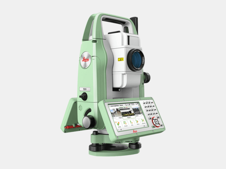
TOTAL STATION
With an angular accuracy of 1″, a distance accuracy up to 1 mm, and a range of 0.9-3,500 m, the TS10 establishes survey control that enables the most accurate terrestrial 3D laser scan registration possible.
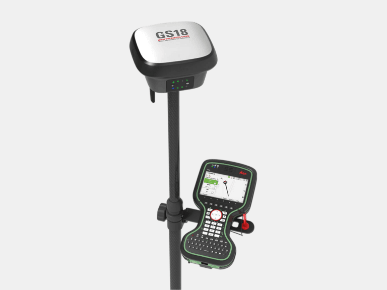
RTK GNSS ROVER
With an accuracy up to 8 mm and tilt compensation, the GS18 T quickly georeferences data into your required coordinate system for consistent field-to-office alignment.
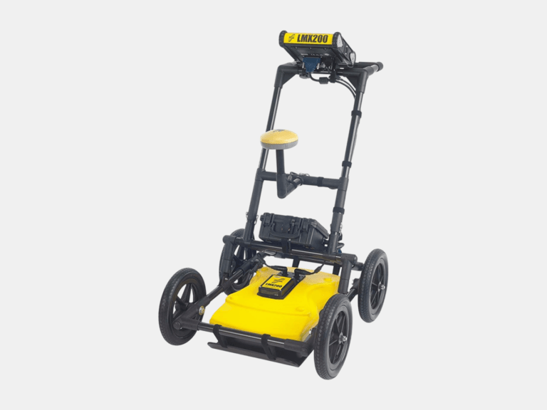
GROUND PENETRATING RADAR (GPR)
With an ultra-wideband 250 MHz GPR antenna and a depth penetration up to 8 m, the LMX200 maps buried utilities, including metallic and non-metallic pipes, for confident subsurface awareness.
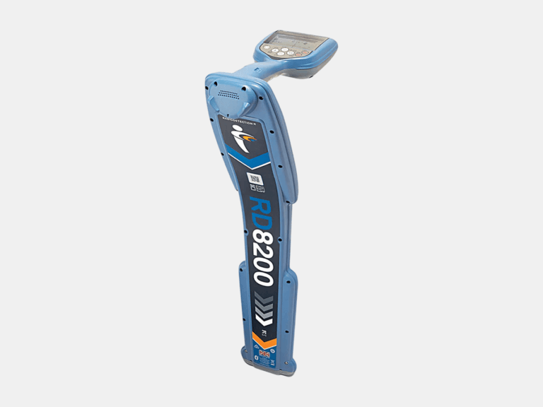
CABLE & PIPE LOCATOR
With a depth measurement accuracy of ±3%, a locate accuracy of ±5%, and a depth readout up to 30 m, the RD8200 pinpoints underground cables and pipes with high confidence.
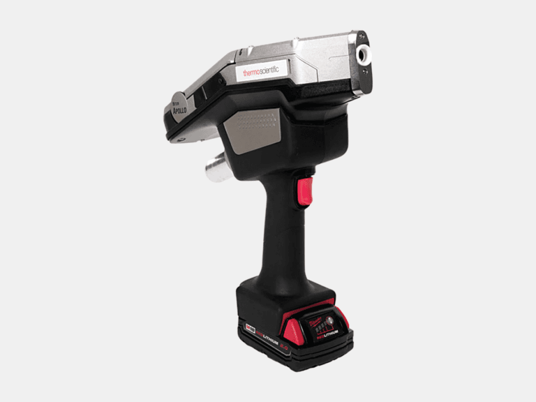
HANDHELD LIBS ANALYZER
Using a handheld LIBS analyzer, the Niton Apollo detects C, Al, Si, Ti, V, Cr, Mn, Co, Ni, Cu, Nb, Mo, and W on-site to differentiate steel grades beyond XRF.
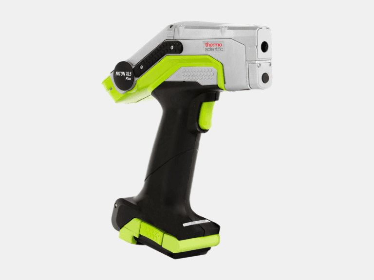
HANDHELD XRF ANALYZER
Using a handheld XRF analyzer, the Niton XL5 Plus identifies and quantifies elements from Mg to U on-site for rapid alloy identification and PMI.
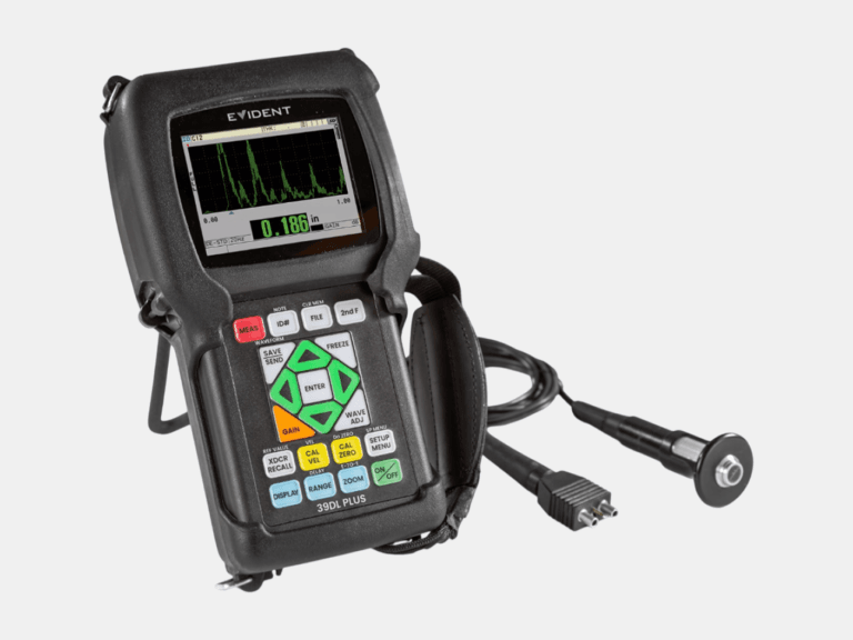
ULTRASONIC THICKNESS GAUGE
With a thickness range of 0.08-635 mm and multilayer capability to measure up to four individual layers, the 39DL PLUS delivers reliable ultrasonic thickness measurements.
Common Applications
Where Construction Verification Delivers Value
As-Built Deliverables
Sample Inspection Reports
Bridge
Construction Verification Report
- Deformation
- Deviation
- Deviation Sections
- Surface Flatness
- Surface Levelness
- Slope Analysis
- Deformation
- Deviation
- Deviation Sections
- Surface Flatness
- Surface Levelness
- Slope Analysis