
TUNNELING
layouts, expansions, and critical infrastructure.

TUNNELING
layouts, expansions, and critical infrastructure.
TUNNELING
layouts, expansions, and critical infrastructure.


Mining & Tunneling
3D Asset Capture for Mining & Tunneling Operations
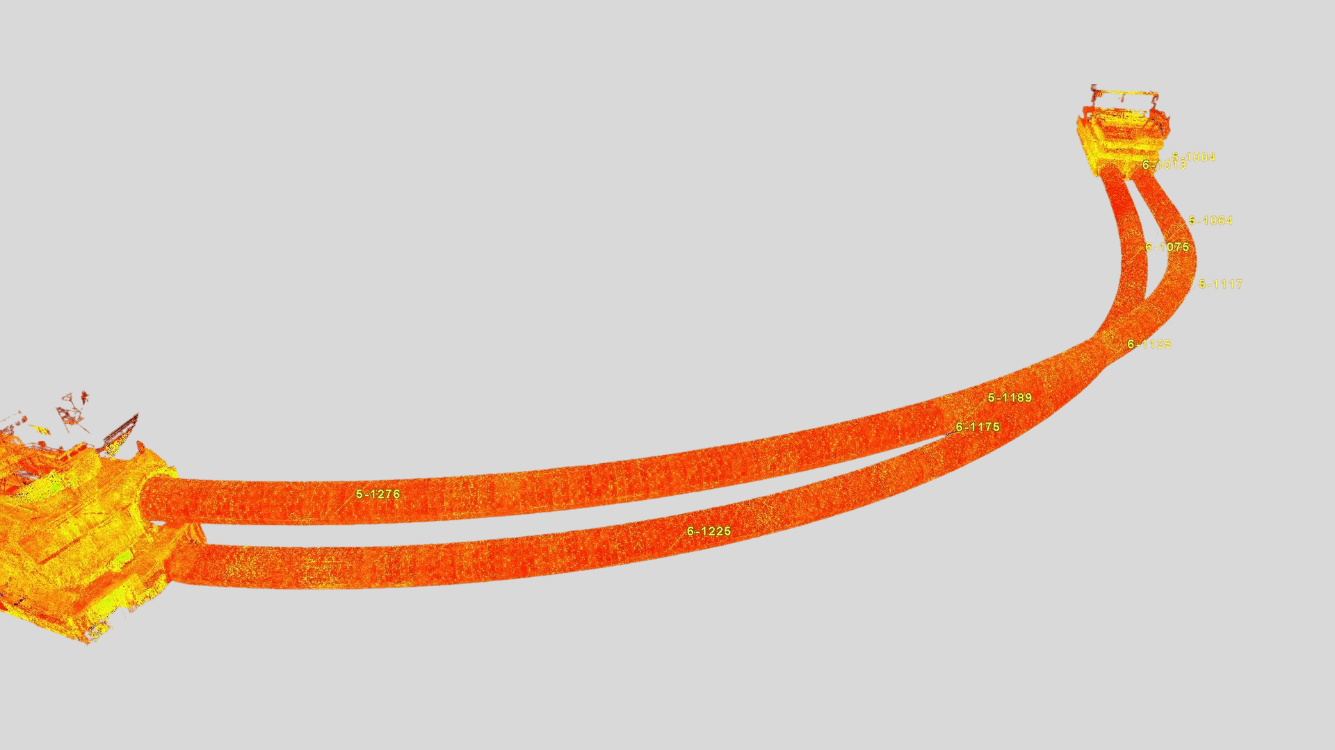
In mining and tunneling projects, accurate as-built data is essential for safe operations, efficient maintenance, and effective planning. This is especially true in mining processing plants, where dense arrangements of structural steel, piping, tanks, conveyors, crushers, and mechanical equipment make traditional measurement and survey methods slow, disruptive, and limited in the level of detail they can provide. In contrast, 3D laser scanning enables the fast, accurate, and comprehensive capture of spatial 3D data, allowing existing conditions to be documented with a far higher level of precision and data density while reducing operational disruptions and costly shutdowns.
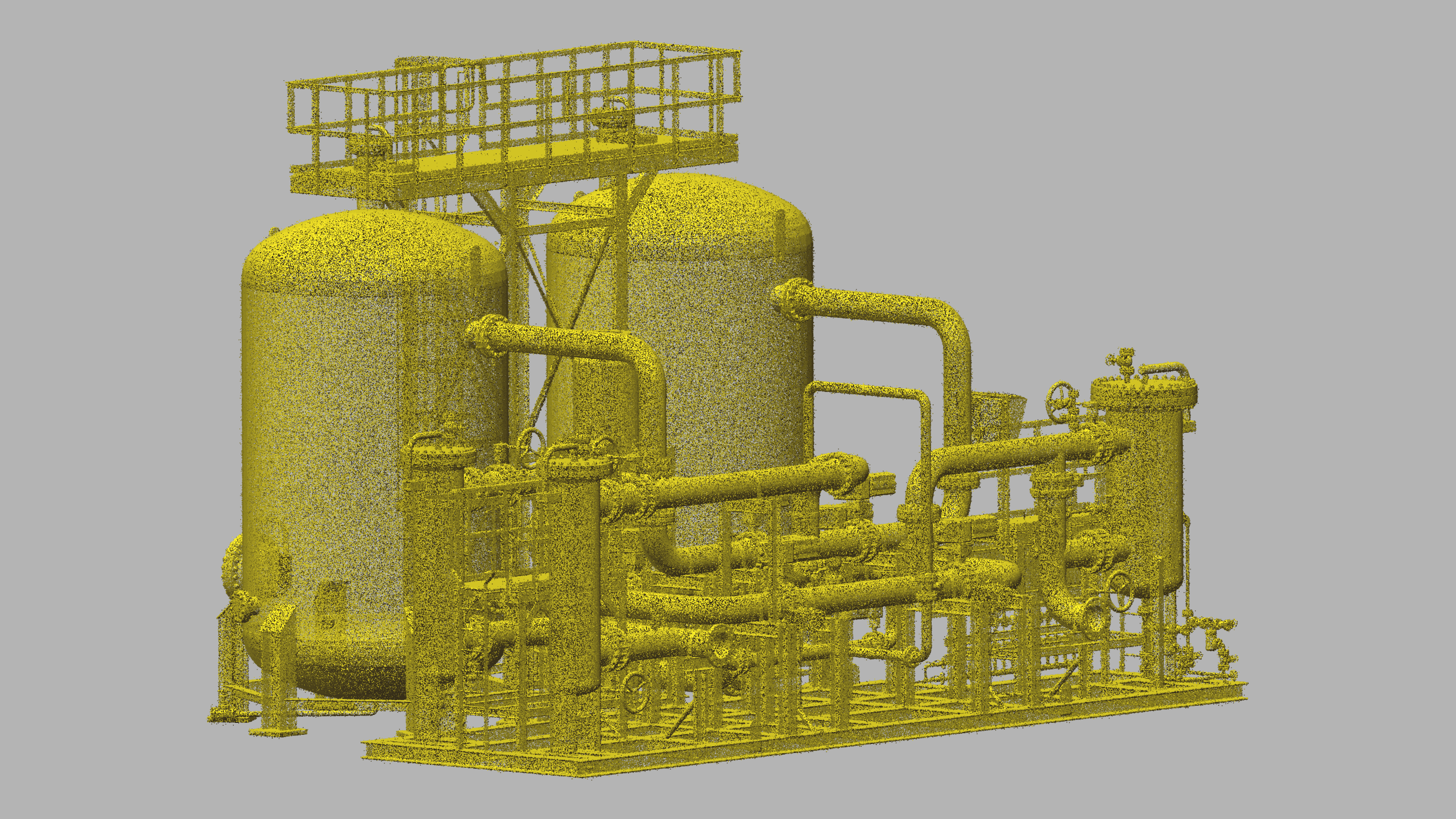
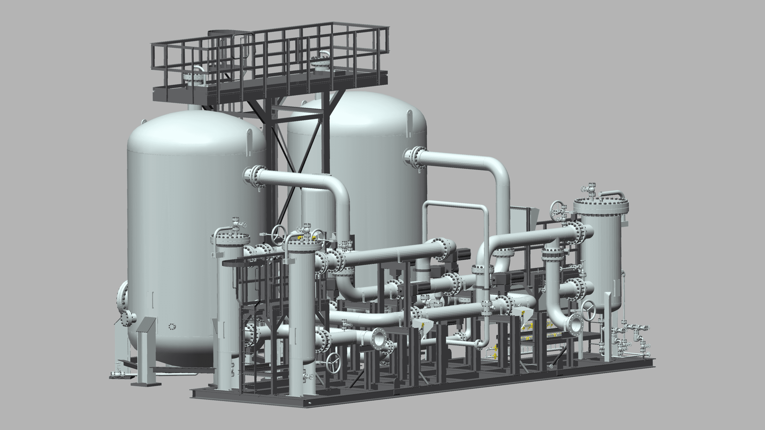
For mining processing plants, 3D laser scanning is highly effective for capturing complex existing conditions and producing precise as-built digital deliverables, including registered point clouds, 3D mesh models, 3D CAD models, BIM models, plant design models, and 2D CAD documentation. These deliverables support inspection, maintenance, retrofit, expansion, and brownfield modification projects by giving engineering teams accurate site data to work from instead of outdated drawings or incomplete field measurements. Even in congested areas with platforms, piping, heavy machinery, and material handling systems, existing conditions can be documented quickly and accurately.
Beyond processing plants, 3D laser scanning is also highly valuable for underground and surface mining operations, tunnels, shafts, drifts, and other excavation environments where ongoing monitoring is critical. By comparing periodic 3D laser scan data over time, changes in geometry can be identified and analyzed to detect deformation, movement, wear, or other signs of potential instability. In the mining and tunneling sectors, we also perform laser tracker alignment & inspection, storage tank inspection & calibration, volume surveys, construction verification, deformation & wear analysis, topographic mapping & georeferencing, GPR (underground mapping), VR/AR & 3D digital content modeling, and LIBS, XRF, & ultrasonic thickness analysis, along with other high-precision measurement services that support planning, inspection, and operational decision-making across both processing plants and mining infrastructure.
Our Deliverables
As-Built Products for Mining & Tunneling
As-Built Modeling
Scan to CAD - From Accurate Point Cloud to Precise 3D CAD Models
As-Built Deliverables
Sample Inspection Reports
Tunnel
Tunnel Inspection Report
- 3D Inspection
- Deformation Analysis
- Cross Sections
- Volume Over / Under