& ARCHITECTURE
support accurate planning, design, and construction.

& ARCHITECTURE
support accurate planning, design, and construction.
& ARCHITECTURE
support accurate planning, design, and construction.


Civil Engineering & Architecture
As-Built Scan to BIM & Scan to CAD Services
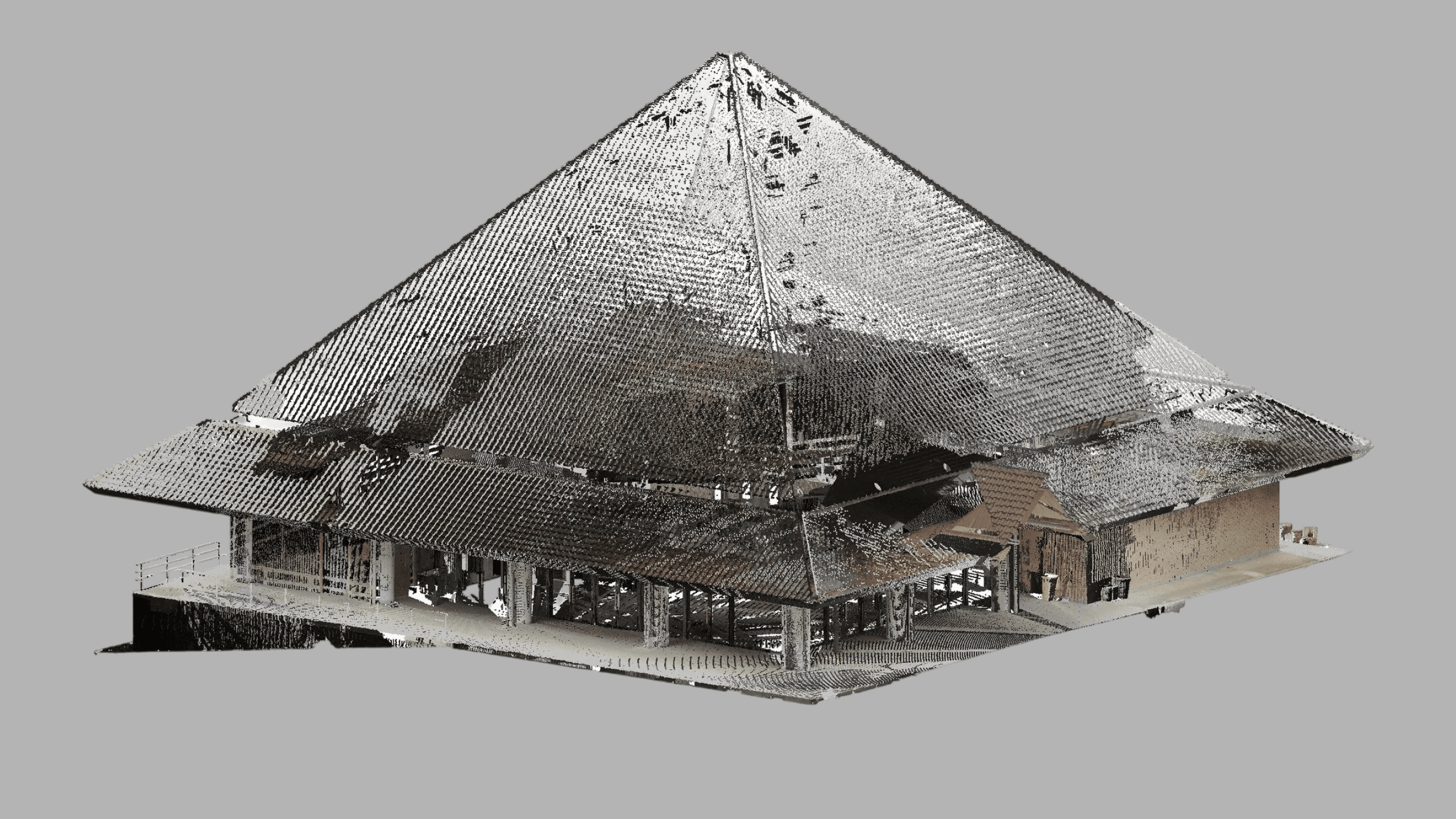
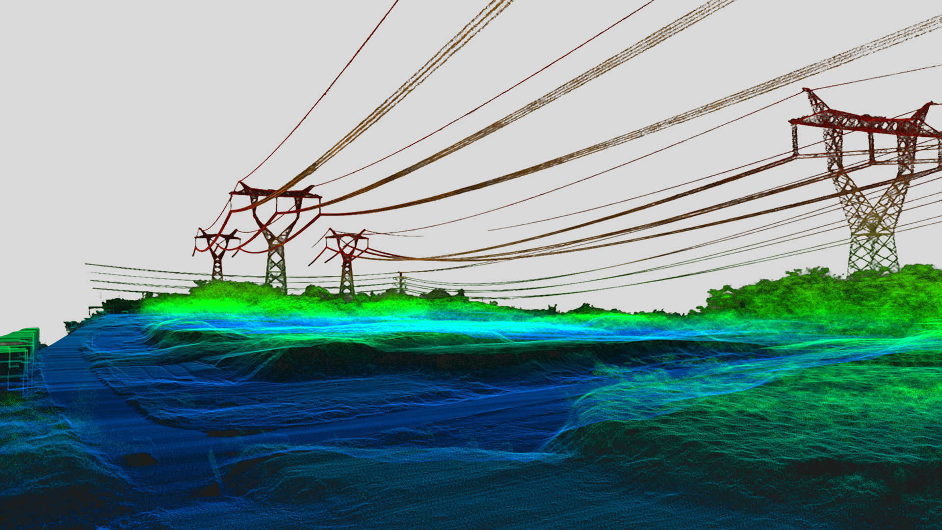
In civil engineering and architecture, accurate existing-condition data is fundamental to good design, successful renovation, efficient construction, and long-term asset management. Compared with traditional surveying methods, 3D laser scanning offers a faster, more accurate, and more complete way to document structures, buildings, and surrounding environments. Its dense spatial 3D data allows the full geometry and condition of a site to be recorded in a level of detail that conventional methods often cannot achieve.
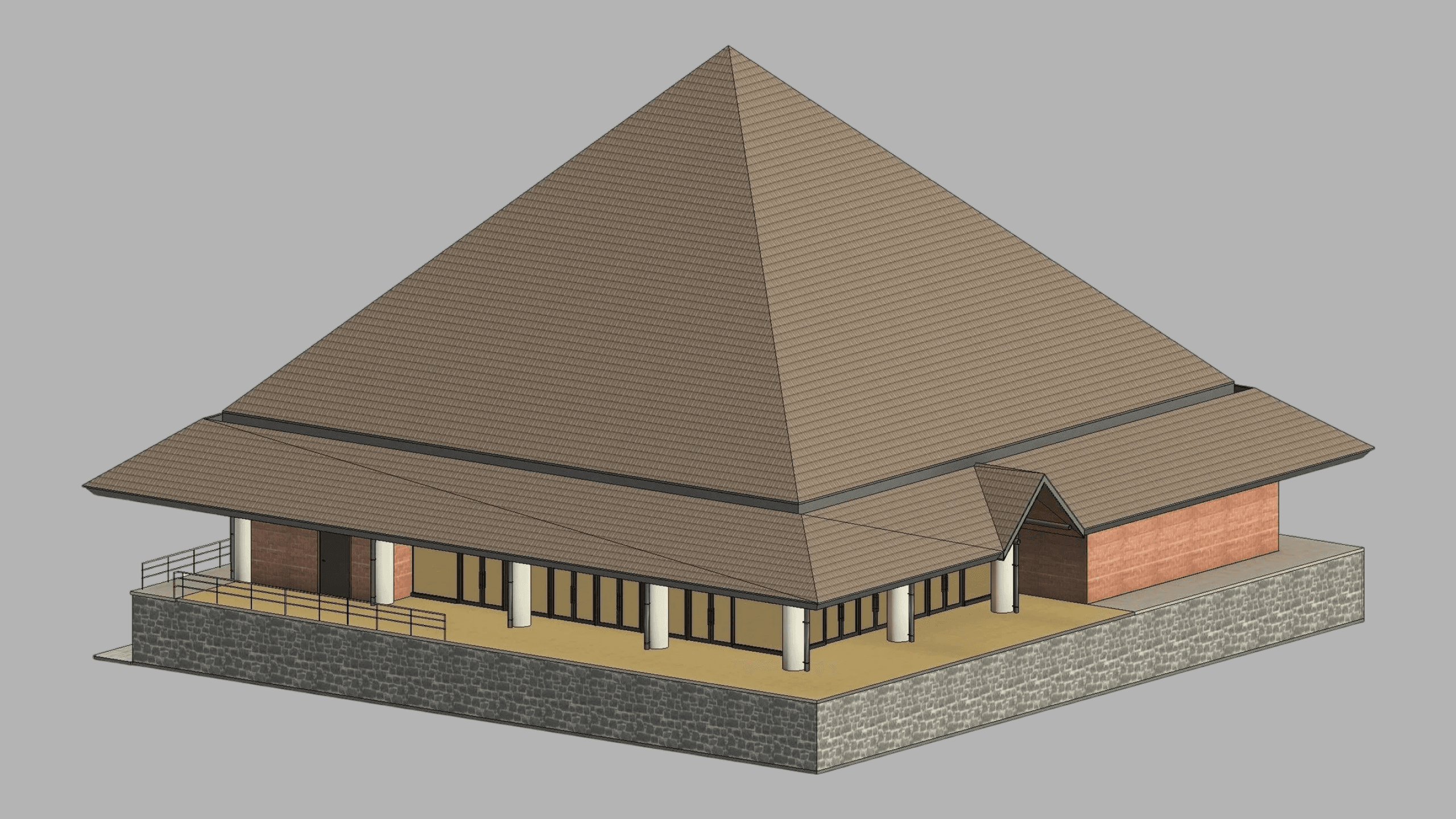
Using 3D laser scanning, we produce a wide range of as-built digital deliverables for civil and architectural projects, including BIM models, 2D and 3D topographic models, and 2D CAD documentation such as architectural drawings, floor plans, section views, and elevation views. Depending on the requirements of the project, we also deliver registered point clouds, 3D mesh models, 3D CAD models, and plant design models. These outputs are well suited for planning, design development, renovation, retrofit, restoration, and documentation across everything from individual buildings to infrastructure and large-scale developments.
Because 3D laser scanning captures existing conditions quickly and accurately, it helps reduce repeated site visits, improves coordination across architectural, engineering, and construction teams, and provides dependable as-built information for decision-making. In addition, we provide laser tracker alignment & inspection, storage tank inspection & calibration, volume surveys, construction verification, deformation & wear analysis, georeferencing, GPR (underground mapping), VR/AR & 3D digital content modeling, and LIBS, XRF, & ultrasonic thickness analysis. This enables project teams to move forward with greater confidence from initial planning through construction and long-term asset management.
Our Deliverables
As-Built Products for Civil Engineering & Architecture
As-Built Modeling
Scan to BIM - From Accurate Point Cloud to Precise BIM Models